Worcester County, Maryland
| Worcester County, Maryland | ||
|
||
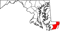 Location in the state of Maryland |
||
 Maryland's location in the U.S. |
||
| Founded | 1742 | |
|---|---|---|
| Seat | Snow Hill | |
| Area - Total - Land - Water |
695 sq mi (1,800 km²) 473 sq mi (1,225 km²) 221 sq mi (572 km²), 31.88% |
|
| Population - (2000) - Density |
46,543 98/sq mi (38/km²) |
|
| Website | www.co.worcester.md.us | |

Worcester County (pronounced /ˈwʊstər/) is the easternmost county located in the U.S. state of Maryland. The county contains the entire length of the state's Atlantic coast line. It is home to the popular vacation resort area of Ocean City. It was named for an Earl of Worcester. Its county seat is Snow Hill.[1] It is included in the Ocean Pines, Maryland, Micropolitan Statistical Area. The population was 46,543 at the 2000 census.[2]
Contents |
History
Worcester County was created by the division of Somerset County in 1742. The county seat, previously located near the confluence of Dividing Creek with the Pocomoke River, was transferred to the river port of Snow Hill, at the head of navigation of the Pocomoke, near the center of the new county.
Both Somerset and Worcester Counties were early on divided into hundreds, from south to north: Mattapony, Pocomoke, Boquetenorton, Wicomico, and Baltimore Hundreds. Later subdivisions of the hundreds added Pitts Creek, Acquango, Queponco, and Buckingham & Worcester Hundreds, all of which in turn became election districts following American independence. Competing territorial claims between the Calverts of Maryland and the Penns of Pennsylvania and of what later became the state of Delaware led to the surveying of Worcester County's northern border, the Transpeninsular Line in 1751, though boundary disputes continued through the rest of the colonial period. In 1779, Stephen Decatur, hero of the Barbary Wars, was born at Sinepuxent, near what is today the town of Berlin.
Originally settled almost entirely by immigrants of British and Irish stock, Worcester County was divided during the colonial period into several parishes, though Quakers, Presbyterians, and later Methodists also set up meeting houses. Like the Border States in general, Worcester County had a high proportion of Free people of color for many decades before the Civil War, due in part to the influence of, first, Quakerism, and later Methodism.
Worcester County was primarily an agricultural area from its inception, first planting tobacco, but when the quality produced in the area's sandy soil could not compete with that produced elsewhere, growing wheat, corn, and livestock. Early industrial activity included the smelting of bog iron ore in a brick blast furnace to make pig iron at Furnacetown in the first half of the 19th century. The presence of large baldcypress swamps along the Pocomoke River led to logging, the manufacture of roofing shingles, and shipbuilding along the river at Newtown (later Pocomoke City). The arrival of steam-powered water transport and then the railroad opened urban markets to another of Worcester County's principal products: seafood, particularly shellfish. Oysters, clams, and crabs were shipped to Baltimore, Philadelphia, and New York. Soon after the Civil War (to each side of which Worcester County sent soldiers), parts of both Worcester and Somerset Counties were combined to create, in 1867, Wicomico County. Also in the later 19th century, the seaside resort of Ocean City was founded.
Truck farming and the canning industry came to the fore during the early 20th century. However, both the seafood industry and truck farming declined after mid-century, due to overfishing on the one hand, and the opening of California's Central Valley to irrigated agriculture on the other, but the advent of the large-scale poultry industry filled this gap. The expansion of Ocean City since the 1960s has turned the northern part of the county from a summer resort to an expanding year-round community.
Two major storms influenced the course of Worcester County history in the 20th century: the hurricane of 1933, which badly damaged Ocean City and Public Landing, but also cut the Ocean City Inlet, and the nor'easter of 1962, which destroyed much of the residential development on Assateague Island and led to the creation of the National Seashore.
The county has a number of properties on the National Register of Historic Places.[3]
Law and government
Worcester County was granted home rule in 1976 under a state code. There is a circuit court located in Snow Hill and two district courts.
Education
The following institutions are part of the Worcester County public school system, governed by the Worcester County Board of Education:
- Showell Elementary School
- Buckingham Elementary School
- Ocean City Elementary School
- Snow Hill Elementary School
- Pocomoke Elementary School
- Berlin Intermediate School
- Stephen Decatur Middle School
- Snow Hill Middle School
- Pocomoke Middle School
- Stephen Decatur High School
- Snow Hill High School
- Pocomoke High School
- Worcester Technical High School
- Cedar Chapel Special School
In the fall of 2008 Worcester County has plans to open Worcester Technical High School to all residents of the county, to replace Worcester Career and Technology Center.
The following private schools also operate in Worcester County:
- Worcester Preparatory School
- Seaside Christian Academy
- Most Blessed Sacrament Catholic School
- Snow Hill Mennonite School
- The Tidewater School by the Sea
Geography
According to the U.S. Census Bureau, the county has a total area of 695 square miles (1,799 km²), of which 473 square miles (1,226 km²) is land and 221 square miles (574 km²) (31.88%) is water.
The terrain is mostly level and coastal. The lowest elevation is sea level along the Atlantic Ocean and the highest elevation is 49 ft (15 m) in the northwestern part of the county along State Route 12 just south of the Wicomico County line.
National protected area
- Assateague Island National Seashore (part)
- Chincoteague National Wildlife Refuge (part)
Transportation
Major U.S. Highways in Worcester County include U.S. Route 50, whose east end is in Ocean City. US 50 serves as one of the main access points to Ocean City, also surrounded by a vast amount of commercial development. U.S. Route 13 is the main north–south route of the Delmarva Peninsula, providing access to Pocomoke City. U.S. Route 113 is the main north–south artery of Worcester County, and is well-known locally for its dangerous two-lane sections which are currently being addressed. US 113 also possesses a business route through Snow Hill. Major state highways include Maryland Route 90, which is a freeway from US 50 to northern Ocean City, and Maryland Route 12, which connects Snow Hill and Salisbury.
Freight trains run into Delaware from Snow Hill on the Worcester Railroad, and the main line (formerly Pennsylvania Railroad) from Philadelphia to Cape Charles, Virginia and Norfolk runs through the southeastern corner of the county. A small airport is located near Ocean City, but has no scheduled service.
Adjacent counties
- Accomack County, Virginia (south)
- Somerset County (west)
- Sussex County, Delaware (north)
- Wicomico County (northwest)
Demographics
As of the census[2] of 2000, there were 46,543 people, 19,694 households, and 13,273 families residing in the county. The population density was 98 people per square mile (38/km²). There were 47,360 housing units at an average density of 100 per square mile (39/km²). The racial makeup of the county was 81.20% White, 16.66% Black or African American, 0.18% Native American, 0.61% Asian, 0.02% Pacific Islander, 0.37% from other races, and 0.97% from two or more races. 1.28% of the population were Hispanic or Latino of any race. 15.7% were of German, 13.3% English, 12.6% Irish, 11.1% American and 6.0% Italian ancestry according to Census 2000.
There were 19,694 households out of which 24.50% had children under the age of 18 living with them, 53.20% were married couples living together, 10.80% had a female householder with no husband present, and 32.60% were non-families. 26.30% of all households were made up of individuals and 11.60% had someone living alone who was 65 years of age or older. The average household size was 2.33 and the average family size was 2.79.
In the county the population was spread out with 20.50% under the age of 18, 6.20% from 18 to 24, 26.40% from 25 to 44, 26.90% from 45 to 64, and 20.10% who were 65 years of age or older. The median age was 43 years. For every 100 females there were 95.20 males. For every 100 females age 18 and over, there were 92.30 males.
The median income for a household in the county was $40,650, and the median income for a family was $47,293. Males had a median income of $31,735 versus $24,319 for females. The per capita income for the county was $22,505. About 7.20% of families and 9.60% of the population were below the poverty line, including 17.00% of those under age 18 and 6.40% of those age 65 or over.
Cities and towns
This county contains the following incorporated municipalities:
- 1 City:
- Pocomoke City (incorporated 1865)
- 3 Towns:
- Berlin (incorporated 1868)
- Ocean City (incorporated 1880)
- Snow Hill (incorporated 1812)
Unincorporated areas are also considered as towns by many people and listed in many collections of towns, but they lack local government. Various organizations, such as the United States Census Bureau, the United States Postal Service, and local chambers of commerce, define the communities they wish to recognize differently, and since they are not incorporated, their boundaries have no official status outside the organizations in question. The Census Bureau recognizes the following census-designated places in the county:
- Bishopville
- Girdletree
- Newark
- Ocean Pines
- Showell
- Stockton
- West Ocean City
- Whaleyville
Other unincorporated places not listed as Census-Designated Places but known in the area include:
- Boxiron
- Cedartown
- Friendship
- Germantown
- Goodwill
- Klej Grange
- Libertytown
- Nassawango Hills
- Poplartown
- Public Landing
- Sinnepuxent
- South Point
- Taylorville
- Whiteon
Notable Persons
- Stephen Decatur, Naval Officer
- Linda Harrison, Hollywood actress
References
- ↑ "Find a County". National Association of Counties. http://www.naco.org/Template.cfm?Section=Find_a_County&Template=/cffiles/counties/usamap.cfm. Retrieved 2008-01-31.
- ↑ 2.0 2.1 "American FactFinder". United States Census Bureau. http://factfinder.census.gov. Retrieved 2008-01-31.
- ↑ "National Register Information System". National Register of Historic Places. National Park Service. 2008-04-15. http://www.nr.nps.gov/.
Sources
- Touart, Paul Baker, Along the Seaboard Side: The Architectural History of Worcester County, Maryland (1994).
External links
- Worcester County Government Website
- Worcester County tourism website
- Your Community Link: A Database of Community, Government, and Non-Profit organizations on the Lower Shore
- 1876 Maps of Worcester County (requires Java)
 |
Wicomico County | Sussex County, Delaware | |
|
| Somerset County | Atlantic Ocean | |||
| Accomack County, Virginia |
|
||||||||||||||||||||
|
|||||||||||||||||||||||